Record updated successfully
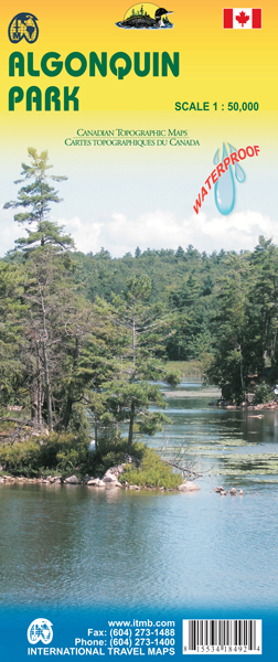
Algonquin National Park kaart, zeer gedetailleerd (schaal 1:50,000) plus op de anderekant van de kaart staat een overzicht van de park, schaal 1:250,000. Natuurkundige overzichtskaart met veel plaatsen en wegen, spoorlijnen en rivieren, hoogten, lengte- en breedtegraden.
Algonquin is an enormous tract of land in central Ontario, Canada, that was set aside as a wilderness preserve generations ago. About the size of Belgium, this preserve of lakes scattered across the Great Canadian Shield consists of dozens of canoe routes, hiking trails, and camping sites in a protected environment that is a national treasure. Our map shows the park and its attractions on one side, and the southern portion (the most used) on the other side. This map is ideal for planning a canoe trip, and canoes can be rented in the park itself. Europeans, as well as Americans, flock to Algonquin, as it is the destination of choice for anyone wanting to 'get away from it all'. Printed on ITM plastic paper, double-sided.
€ 13.95
Bekijk bij dezwerver.nl| Tags | WegenkaartLandkaartTopografischeKaartWandelkaartAlgonquin |
| Identifier | 16445 |
| Name | Wegenkaart - landkaart - Topografische kaart - Wandelkaart Algonquin P |
| ProductCategoryName | Kaarten > Topografische kaarten |
| Description | Algonquin National Park kaart, zeer gedetailleerd (schaal 1:50,000) plus op de anderekant van de kaart staat een overzicht van de park, schaal 1:250,000. Natuurkundige overzichtskaart met veel plaatsen en wegen, spoorlijnen en rivieren, hoogten, lengte- en breedtegraden. Algonquin is an enormous tract of land in central Ontario, Canada, that was set aside as a wilderness preserve generations ago. About the size of Belgium, this preserve of lakes scattered across the Great Canadian Shield consists of dozens of canoe routes, hiking trails, and camping sites in a protected environment that is a national treasure. Our map shows the park and its attractions on one side, and the southern portion (the most used) on the other side. This map is ideal for planning a canoe trip, and canoes can be rented in the park itself. Europeans, as well as Americans, flock to Algonquin, as it is the destination of choice for anyone wanting to 'get away from it all'. Printed on ITM plastic paper, double-sided. |
| Price | 13.95 |
| Extra informatie | |
|---|---|
| GTIN | 9781553418498 |
| CategoryPath | Media > Boeken > Non-fictie > Reisboeken |
| Condition | new |
| Availability | in stock |
| Brand | ITMB |
| Continent | Noord-Amerika |
| Country | Canada |