Record updated successfully

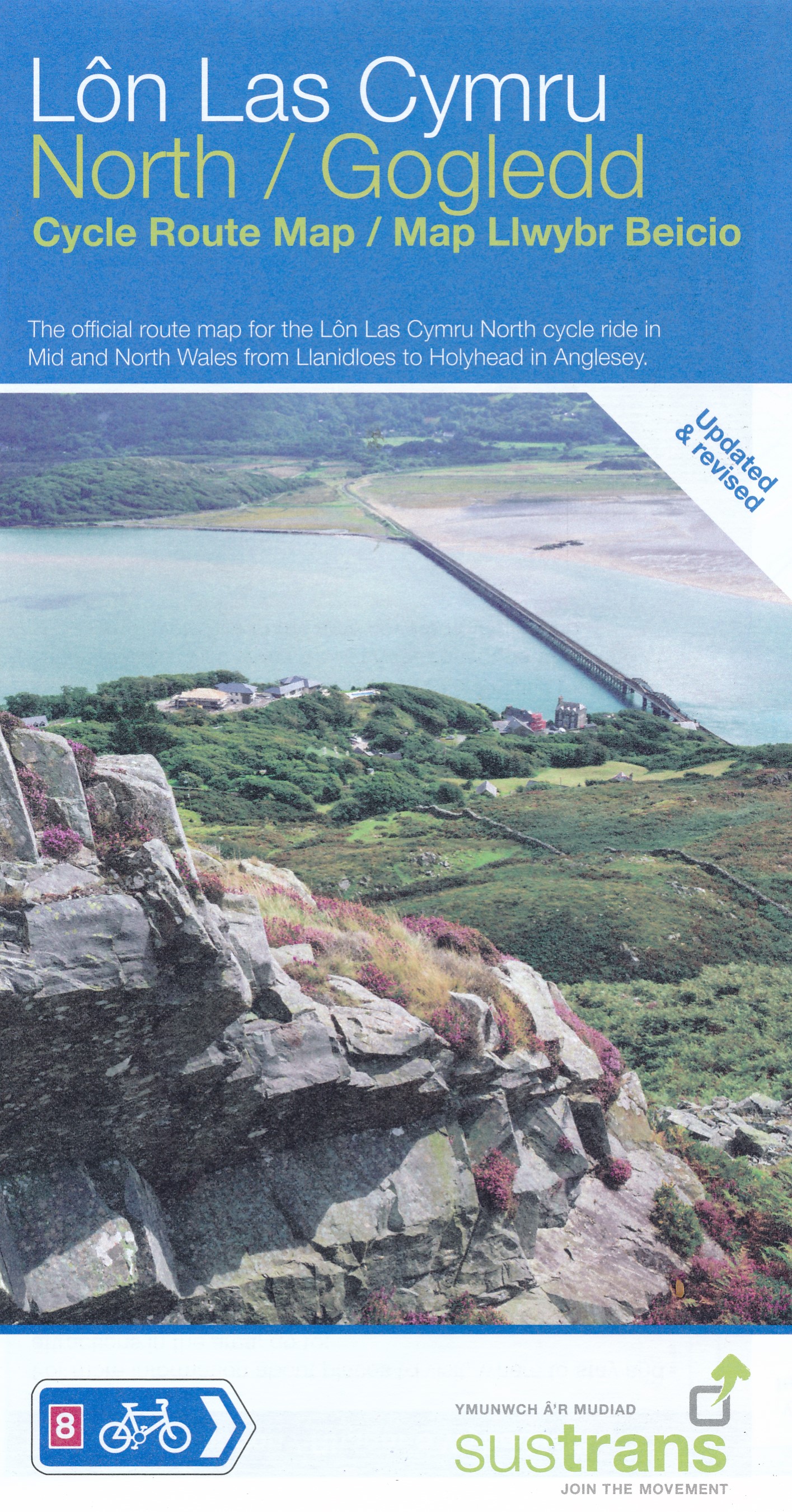
Het is niet een heel overzichtelijke kaart, het zijn juist blokken van een deel van de route waarop deze staat ingetekend. Daarin juist wel heel goed met handige stedenkaarten en route profielen. Eigenlijk voor de route als zodanig onmisbaar, je mist alleen het overzicht een beetje.
This linear map shows the northern section of the Lon Las Cymru route and surrounding area over a series of separate map panels.
The route connects Holyhead and Anglesey to Llanidloes in the Wye Valley, the heart of Wales, using minor roads, railway paths, forestry tracks and ancient coach roads. There are some tough challenges as the route crosses the Snowdonia National Park and the range of the Cambrian Mountains.
This full colour map based on Ordnance Survey data shows clearly mapped cycle routes on traffic-free paths, quiet lanes and roads, with easy to read contours and route profiles. Also features detailed inset maps for the major towns and cities and tourist information.
National Cycle Network Routes covered:
National Route 8 between Holyhead and Llanidloes.
€ 16.95
Bekijk bij dezwerver.nl| Tags | FietskaartCycleRouteMapLônLasCymruNorthSustrans |
| Identifier | 24529 |
| Name | Fietskaart Cycle Route Map Lôn Las Cymru North | Sustrans |
| ProductCategoryName | Kaarten > Fietskaarten |
| Description | Het is niet een heel overzichtelijke kaart, het zijn juist blokken van een deel van de route waarop deze staat ingetekend. Daarin juist wel heel goed met handige stedenkaarten en route profielen. Eigenlijk voor de route als zodanig onmisbaar, je mist alleen het overzicht een beetje. This linear map shows the northern section of the Lon Las Cymru route and surrounding area over a series of separate map panels. The route connects Holyhead and Anglesey to Llanidloes in the Wye Valley, the heart of Wales, using minor roads, railway paths, forestry tracks and ancient coach roads. There are some tough challenges as the route crosses the Snowdonia National Park and the range of the Cambrian Mountains. This full colour map based on Ordnance Survey data shows clearly mapped cycle routes on traffic-free paths, quiet lanes and roads, with easy to read contours and route profiles. Also features detailed inset maps for the major towns and cities and tourist information. National Cycle Network Routes covered: National Route 8 between Holyhead and Llanidloes. |
| Price | 16.95 |
| ImageURL | https://www.dezwerver.nl/media/products/24529/Lon Las North.jpg |
| Extra informatie | |
|---|---|
| GTIN | 9781910845493 |
| CategoryPath | Media > Boeken > Non-fictie > Reisboeken |
| Condition | new |
| Availability | out_of_stock |
| Brand | Sustrans |
| Continent | Europa |
| Country | Engeland |