Record updated successfully

Een leuke set van 2 wandkaarten, de wereld en Afrika, en een opblaasbare globe. Daar de heldere kleuren zijn de landen goed te onderscheiden. Van elk land is ook de hoofdstad weergegeven.
De kaarten en globe zijn engelstalig
Formaat:
- Wandkaart wereld 69 x 100 cm
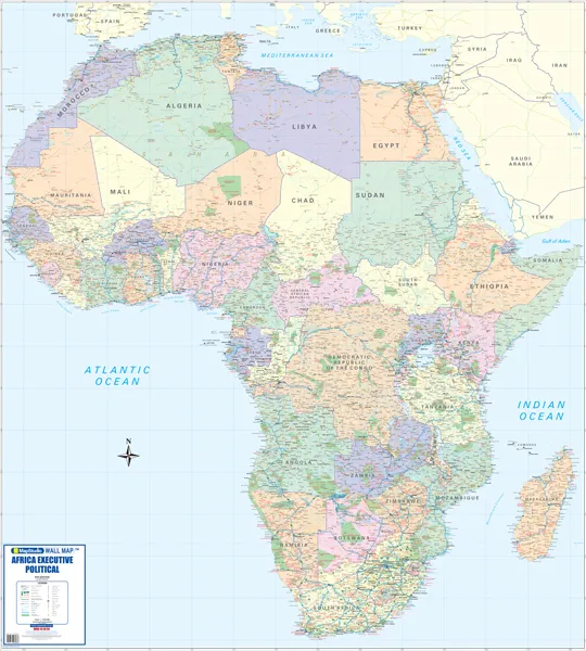
- Wandkaart Afrika 100 x 69 cm
- Opblaasbare globe 30 cm
World Map
updated maps from our reliable map database
clear easy-to-read mapping on a large format sheet
bright colours with clear legible text
all countries of the world & their capitals listed
disputed international boundaries
bright colours highlighting each country• map legend, north point & scale bar
Africa Map
New updated maps from our reliable map database
clear easy-to-read mapping on a large format sheet
all countries of africa and their capitals
bright colours highlighting each country
clear legible text
locator map showing position of african continent
flags of all african countries shown
map legend, north point & scale bar
major connecting roads
Inflatable Globe
Learner-friendly type
great educational tool
colour coded countries
capital cities
latitude & longitude
international boundaries
elevation
international time zones
international date line
physical features
oceans & seas
drainage
€ 24.95
Bekijk bij dezwerver.nl| Tags | OpblaasbareWereldbolGlobeMapsBoxAfricaWorldMapstud |
| Identifier | 25363 |
| Name | Opblaasbare wereldbol - globe Maps in a Box - Africa & World | MapStud |
| ProductCategoryName | Wereldbollen > Opblaasbare wereldbollen & globes |
| Description | Een leuke set van 2 wandkaarten, de wereld en Afrika, en een opblaasbare globe. Daar de heldere kleuren zijn de landen goed te onderscheiden. Van elk land is ook de hoofdstad weergegeven. De kaarten en globe zijn engelstalig Formaat: - Wandkaart wereld 69 x 100 cm - Wandkaart Afrika 100 x 69 cm - Opblaasbare globe 30 cm World Map updated maps from our reliable map database clear easy-to-read mapping on a large format sheet bright colours with clear legible text all countries of the world & their capitals listed disputed international boundaries bright colours highlighting each country• map legend, north point & scale bar Africa Map New updated maps from our reliable map database clear easy-to-read mapping on a large format sheet all countries of africa and their capitals bright colours highlighting each country clear legible text locator map showing position of african continent flags of all african countries shown map legend, north point & scale bar major connecting roads Inflatable Globe Learner-friendly type great educational tool colour coded countries capital cities latitude & longitude international boundaries elevation international time zones international date line physical features oceans & seas drainage |
| Price | 24.95 |
| Extra informatie | |
|---|---|
| GTIN | 9781770269415 |
| CategoryPath | Huis en tuin > Decoratie > Wereldbollen |
| Condition | new |
| Availability | in stock |
| Brand | MapStudio |
| Continent | Afrika |